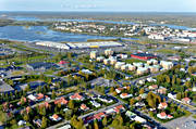
North Bothnia → Cities & Societies → Flygbild över Haparanda

Aerial photo above Haparanda

Picture taken 2010-09-07
From position: Latitude: 65.834912 Longitude: 24.123498
Haparanda Norrbotten Sweden © Copyright: Tomas E Johanson
You can purchase the image digitally for print or website use
Click on the top left corner of the image to open an email
Fill in your requests and send the email to us.
.